Contact us about this property
Darlington Office
Tel: 01325 728084Darlington Farmers Auction Mart, Humbleton Park, Darlington, DL2 2YH
 Request details
Download brochure
Request details
Download brochure
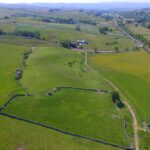
Land at Tebay, Penrith
Property Summary
 Farms & Land
Property Features
- 24.90 hectares (61.51 acres)
- Natural water supplies
- Excellent stone wall boundaries
- Roadside access
- Accessible from Flakebridge Farm
- Available as a whole or in lots
Full Details
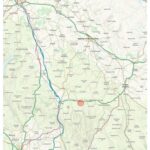
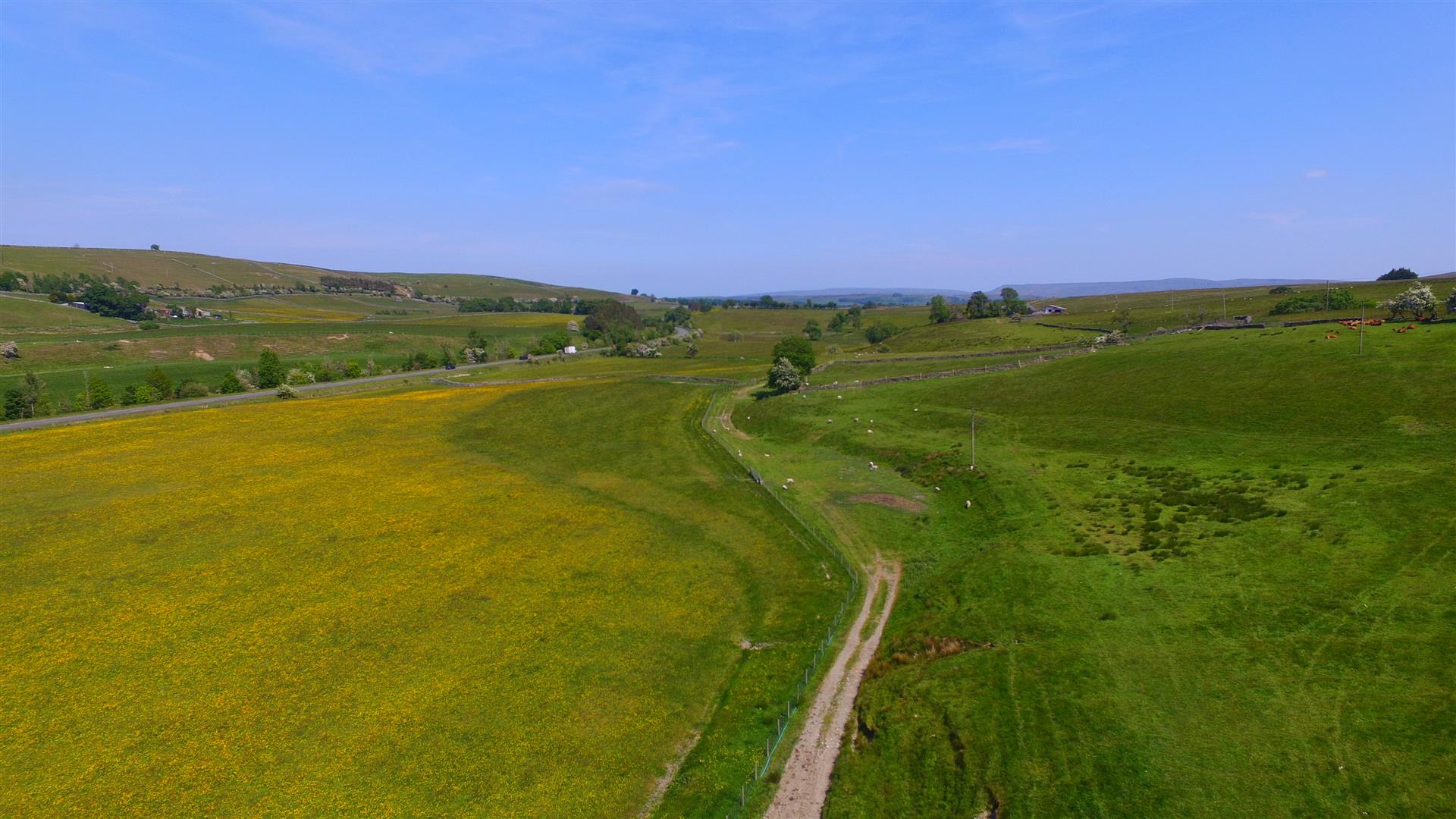
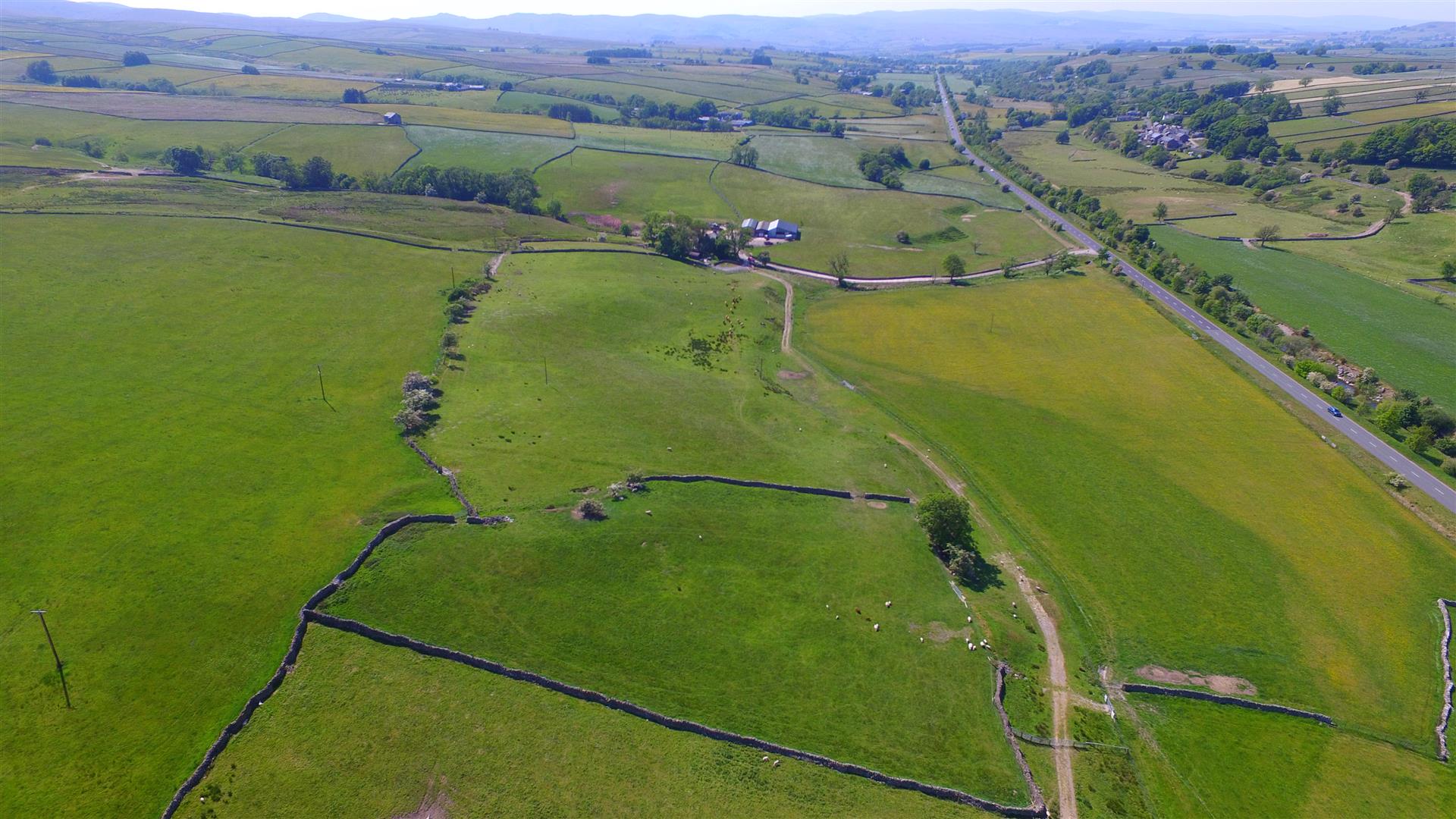
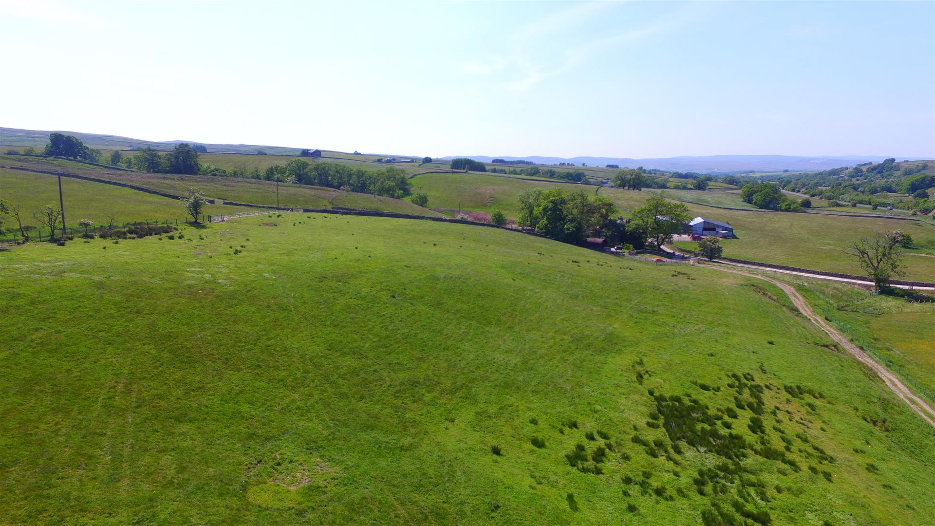
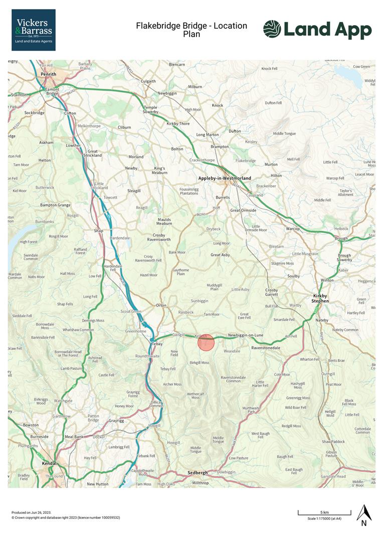
LOCATION
The land at Flakebridge Farm is situated within the Yorkshire Dales National Park, approximately 3.5 miles to the east of Tebay and 8.5 miles west of Kirby Stephen. It is ideally situated to take advantage of major road networks, being 3 miles to the M6 and 12.5 miles to the A66.
What3Words: couriers.glassware.belong
ACCESS
From the M6, exit at junction 38 and head east for 3.5 miles on the A685. From the east, exit the A66 at Brough and head south on the A685 towards Kirby Stephen for 13 miles.
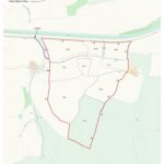
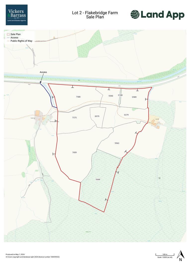
The land will be accessed off Flakebridge Farm access track which leads off the A685. The access is identified by a blue line on the sale plan.
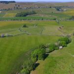
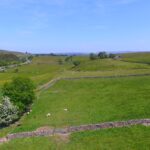
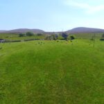
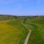
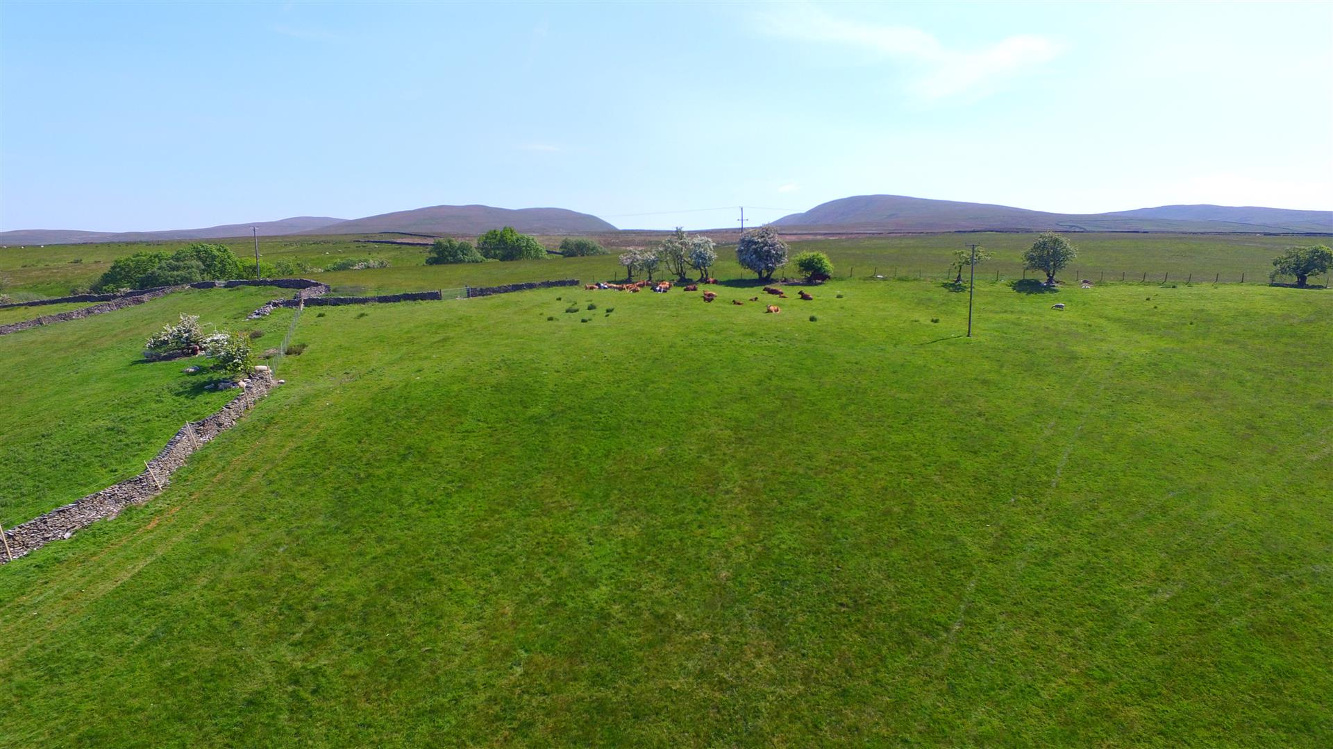
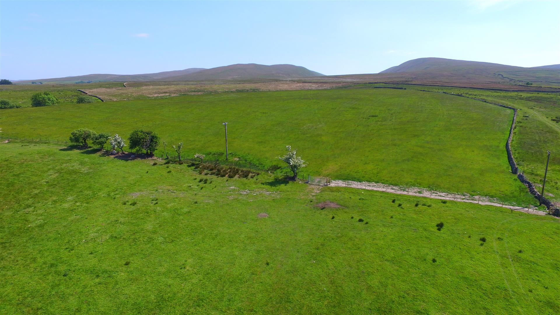
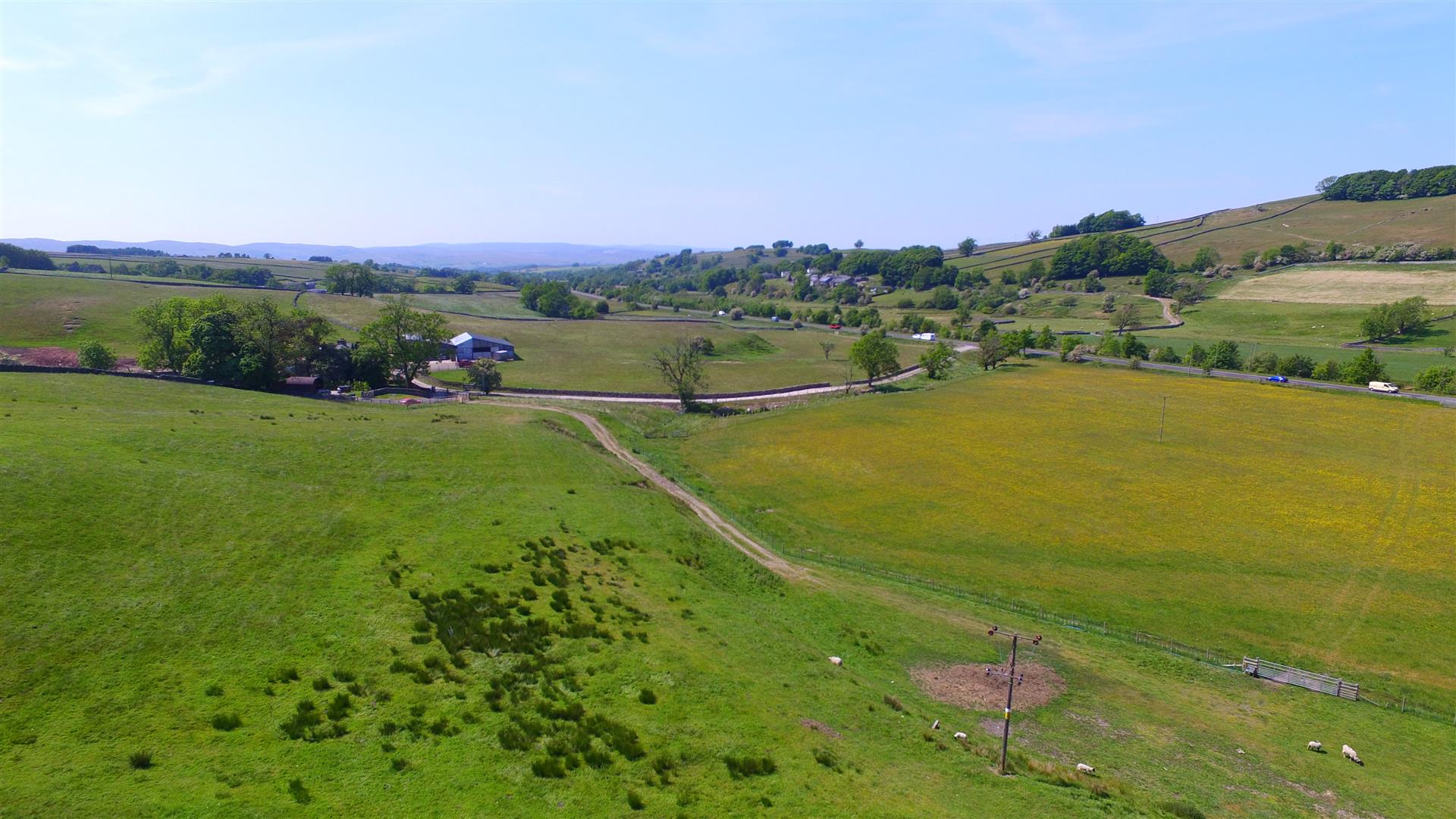
DESCRIPTION
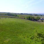
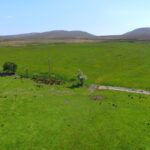
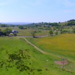
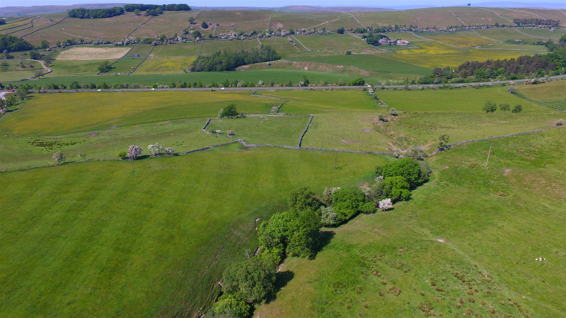
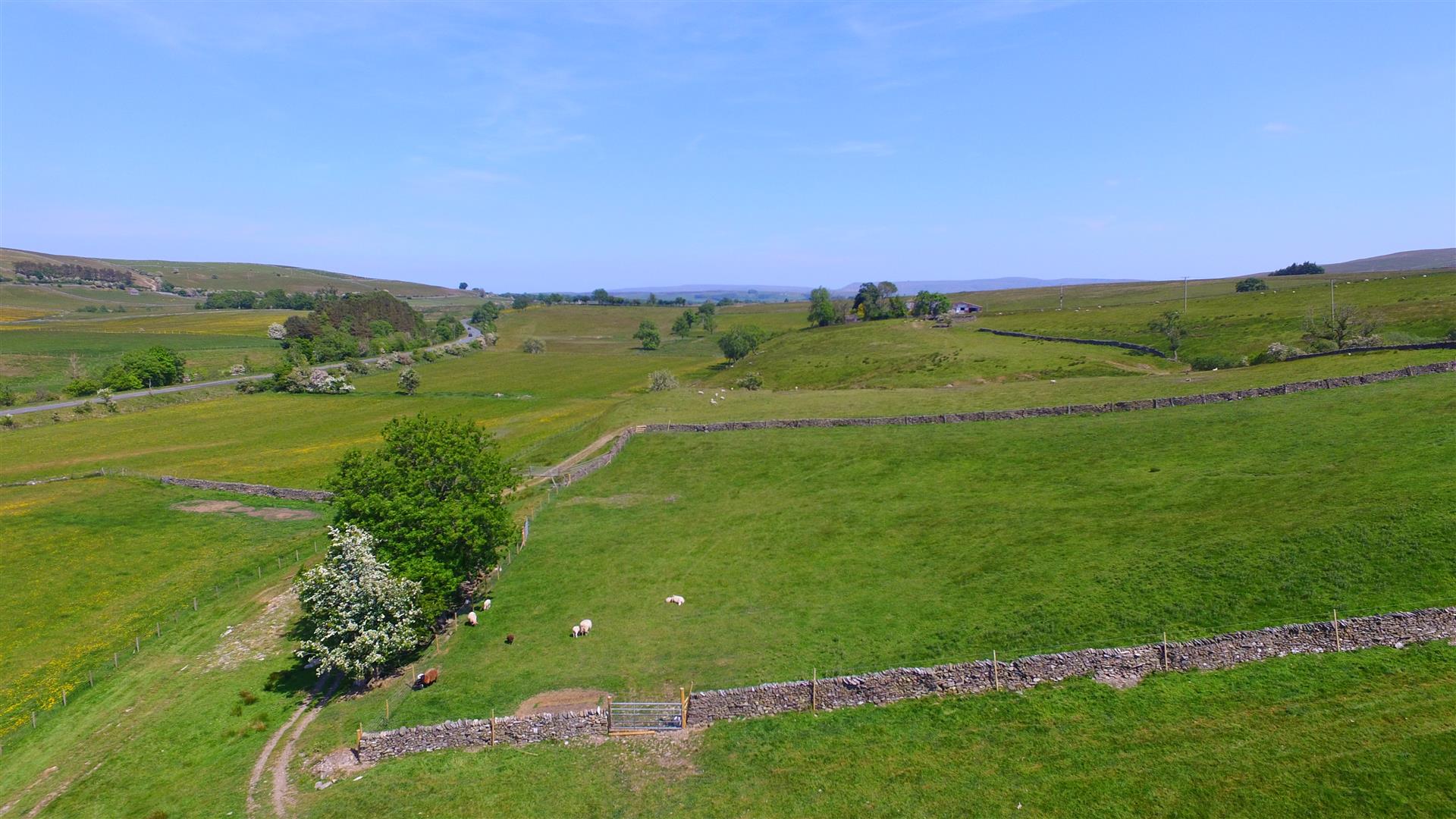
The land at Flakebridge Farm extends to 24.90 hectares (61.51 acres) of predominantly meadow and some pasture and moorland. The land is in good heart and is currently very well managed and farmed. The land could be sold in lots and interested parties are advised to discuss this with the selling agent.
The meadow fields are all productive and high yielding. The boundaries are mainly stone walls, the majority of which are in excellent condition, having been recently improved by the current owners.
The fields are served by a natural water supply.
The majority of the land is classified as Grade 4 and the moorland parcel is classified as Grade 5.
COMMON RIGHTS
The moorland includes grazing rights on Langdale Fell (CL42) and there are also shared rights on Ravenstonedale Common (CL39).
PUBLIC RIGHTS OF WAY
The land is subject to public rights of way; a bridleway leads down the drive and heads east across the land crossing parcels 7588, 9590 and 0279, this is shown by a red dashed line on the Sale Plan. A public footpath continues up the driveway and heads west but does not cross onto the land.
COSTS
Each party is to bear their own costs.
MONEY LAUNDERING
Prospective buyers should be aware that in the event that they are successful they will be required to provide documents in relation to the current Money Laundering and Terrorist Financing Regulations. The extent of the required documentation will be confirmed to the purchaser(s) after acceptance of an offer.
TENURE
We are informed by the current vendors that the property is held freehold.
MATERIAL INFORMATION
It is understood that standard broadband is available and poor mobile telephone signal.
METHOD OF SALE
The property is offered for sale as a whole or in lots by private treaty.
VIEWINGS
Please contact Vickers & Barrass Darlington office on 01325 728084 to arrange a viewing, which are strictly by appointment only.
LOCAL AUTHORITY
Westmorland & Furness Council
www.westmorlandandfurness.gov.uk
0300 373 3300
NOTES
Particulars prepared – October 2023
Photographs taken – June 2023
PARTICULAR NOTES
The particulars are set out as a general outline for the guidance of intending purchasers or lessees and do not constitute, all or part of an offer or contract; all descriptions, dimensions, areas, references to condition and necessary consents for use and occupation and other details are given as a guide only and without responsibility. Any intending purchasers or lessees should not rely on them as statements or representations of fact but must satisfy themselves, by inspection or otherwise, as to their accuracy.
No employee of Vickers & Barrass, Chartered Surveyors has the authority to make or give any representation or warranty whatever in relation to this property nor is any such representation or warranty given by the Vendors or the Lessors of this property.
Any offer for this property will be taken as an admission by the intending purchaser that they have relied solely upon their own personally verified information, inspection, and enquiries.
The photographs show only certain parts of the property. It should not be assumed that the property remains as displayed in the photographs.
Where any reference is made to planning permissions or potential uses, such information is given by Vickers & Barrass, Chartered Surveyors in good faith. Prospective purchasers should make their own enquiries with the Local Planning authority into such matters.
The Vendors reserve the right to amalgamate, withdraw or exclude either of the lots shown at any time and to generally amend the particulars or method of sale.
The property is sold subject to reserve(s).Vickers & Barrass, Chartered Surveyors reserve the right to sell privately without imposing a closing date and do not bind themselves to accept the highest or any offer.
The particulars have been prepared in accordance with the Business Protection from Misleading Marketing Regulations to give a fair overall view of the property.