


Contact us about this property
Darlington Office
Tel: 01325 728084Darlington Farmers Auction Mart, Humbleton Park, Darlington, DL2 2YH
 Request details
Download brochure
Request details
Download brochure
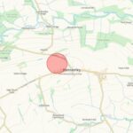
Land at Hamsterley, County Durham
Property Summary
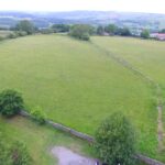
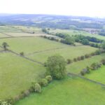
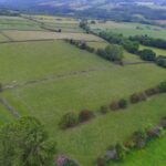
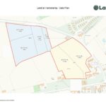
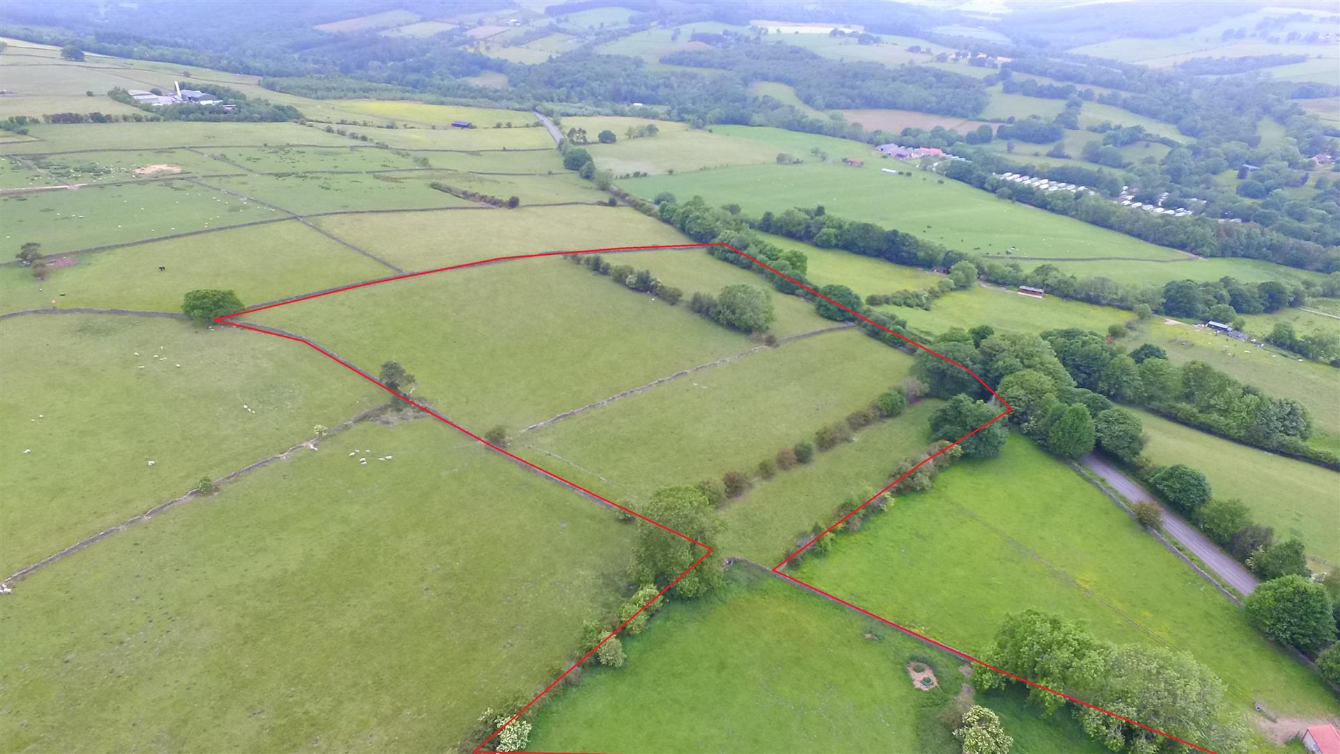
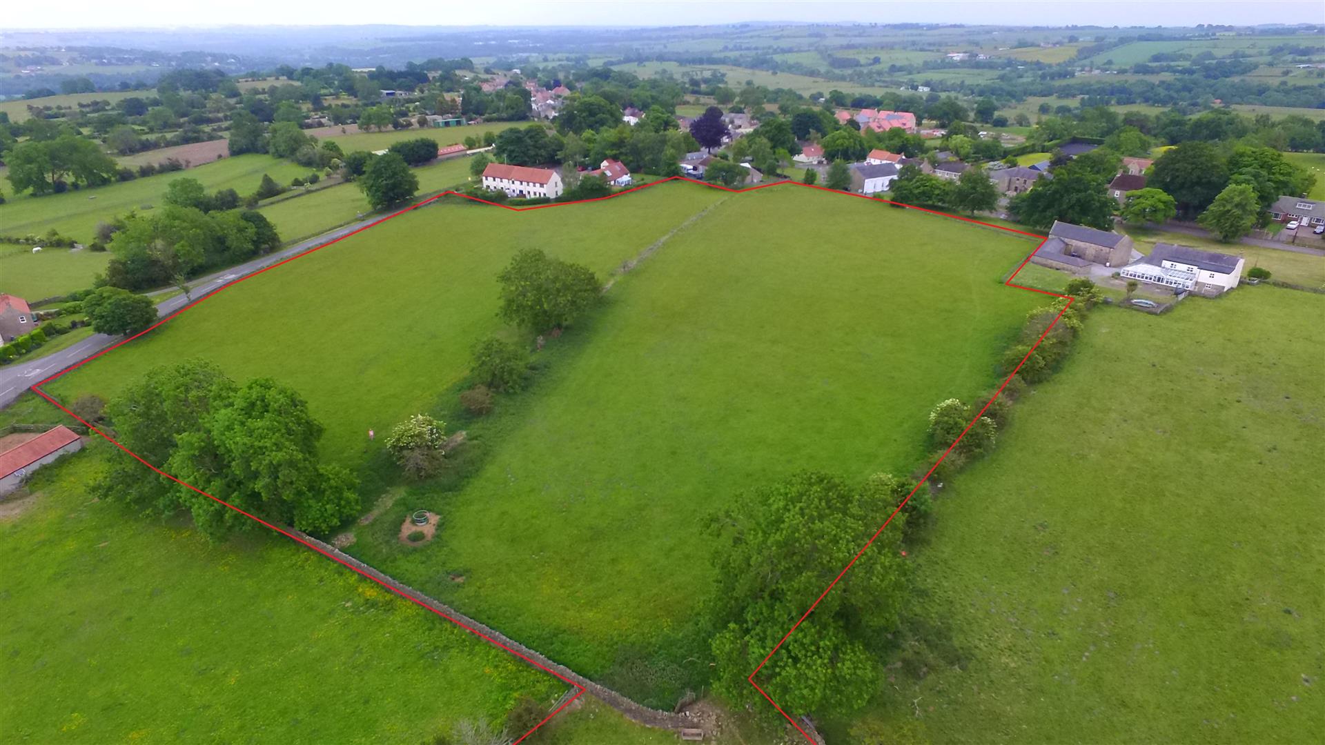
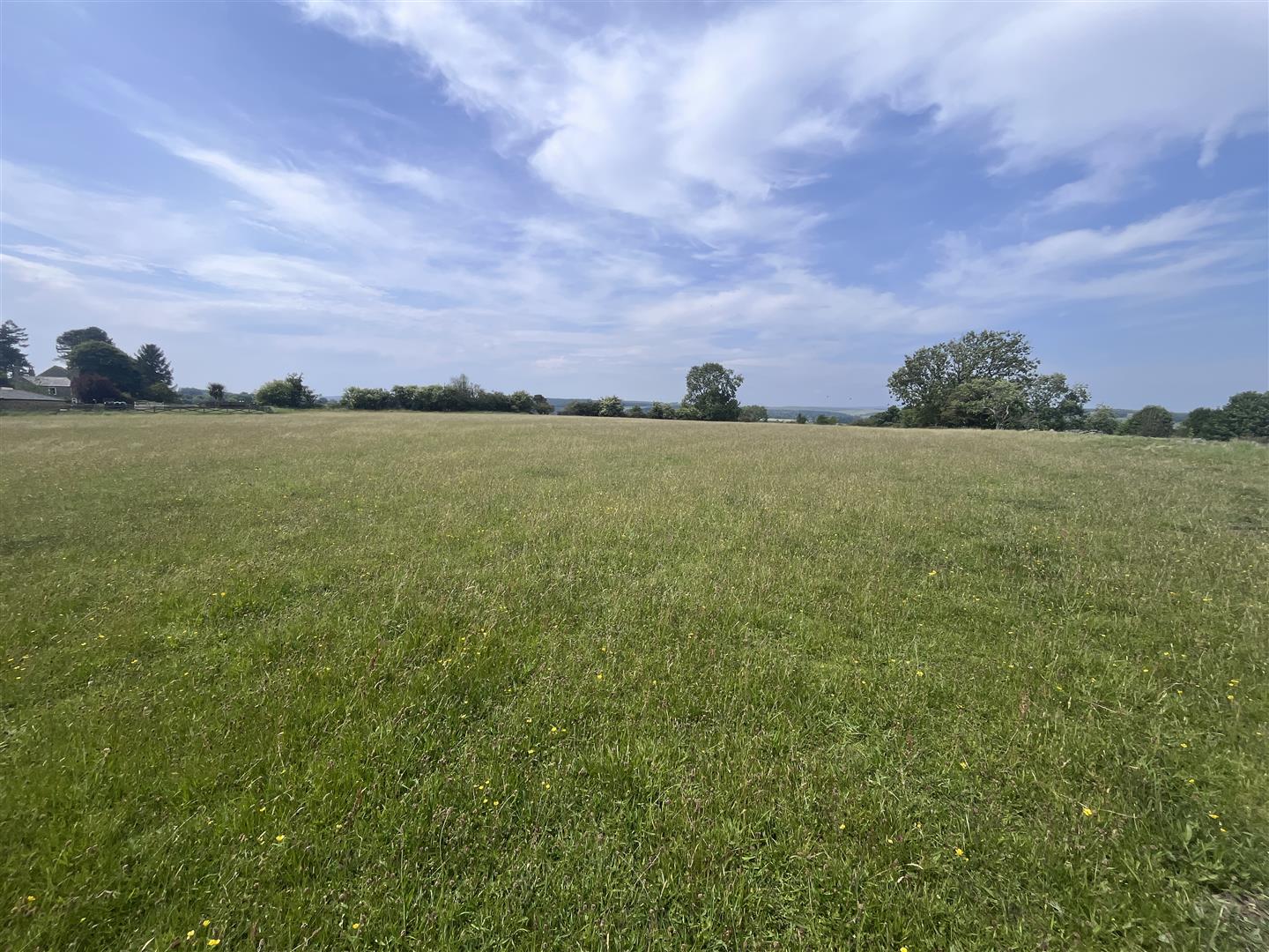
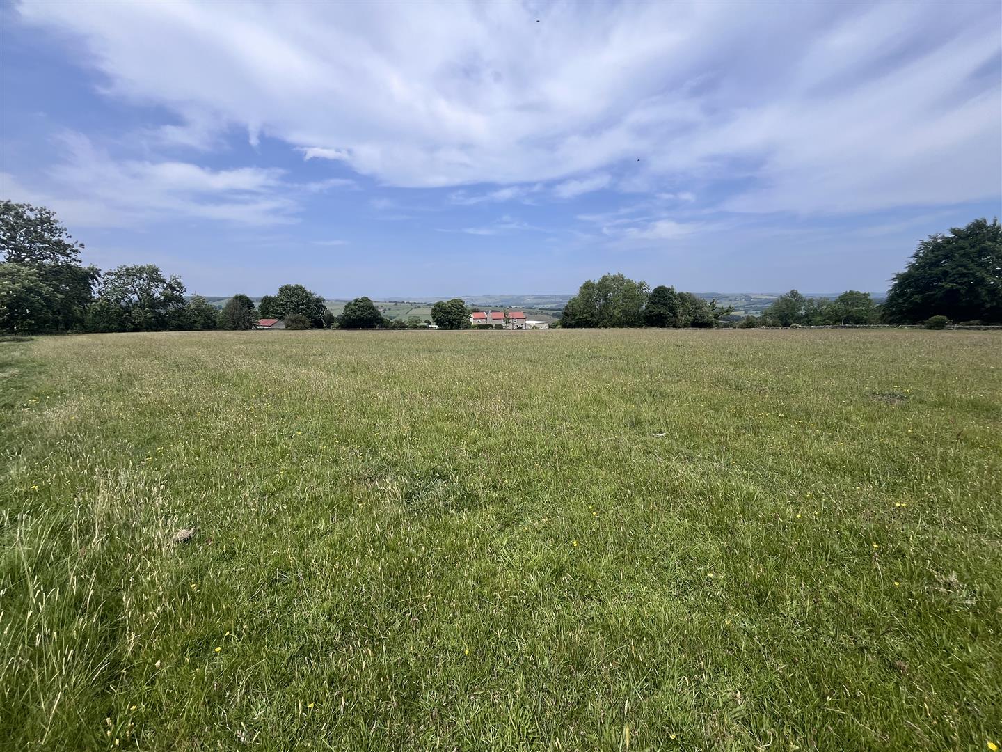
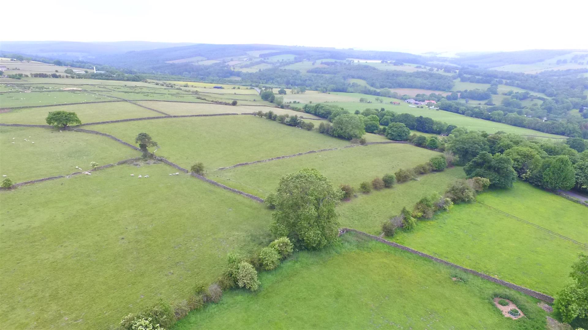
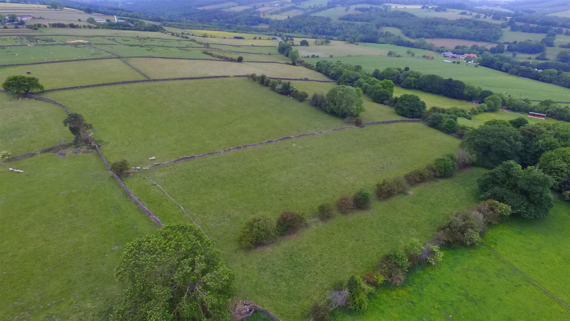
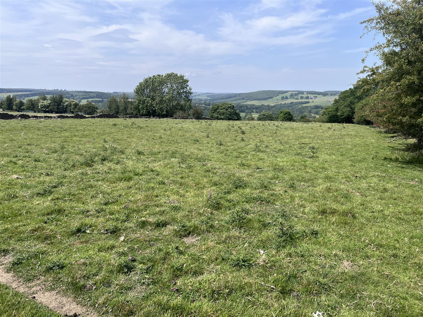
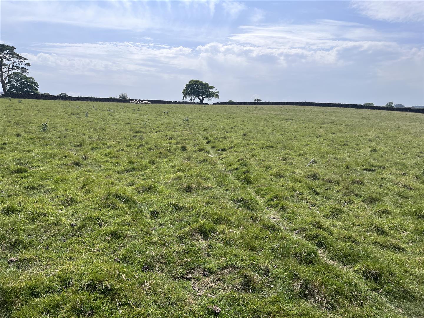
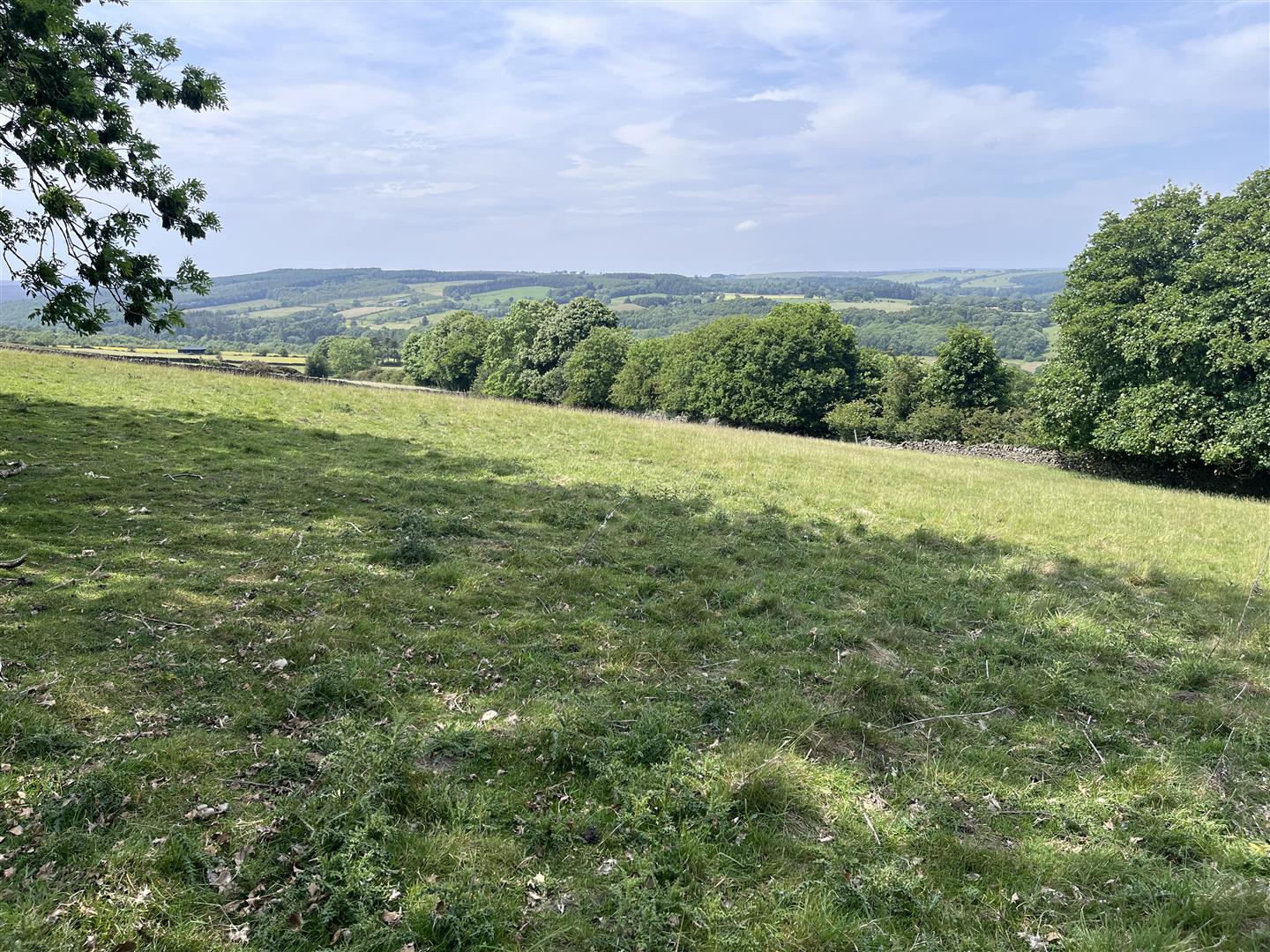
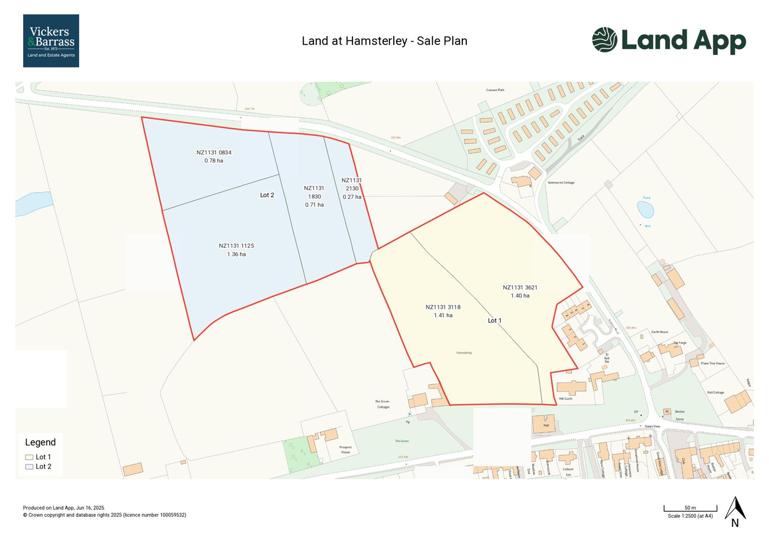
An attractive block of grassland, located in Hamsterley village, comprising two parcels of meadow and four parcels of pasture extending to 5.93 hectares (14.65 acres) in total. The land has two roadside access points and mains water.
The land is available as a whole or in two lots;
Lot 1 - 2.81 hectares (6.94 acres) of meadow - Guide Price 70,000
Lot 2 - 3.12 hectares (7.71 acres) of pasture - Guide Price £45,000
 Farms & Land
Property Features
- Suitable for equestrian purposes
- Village location
- Roadside access
- Mains water connection
- Available as a whole or in two lots
Full Details
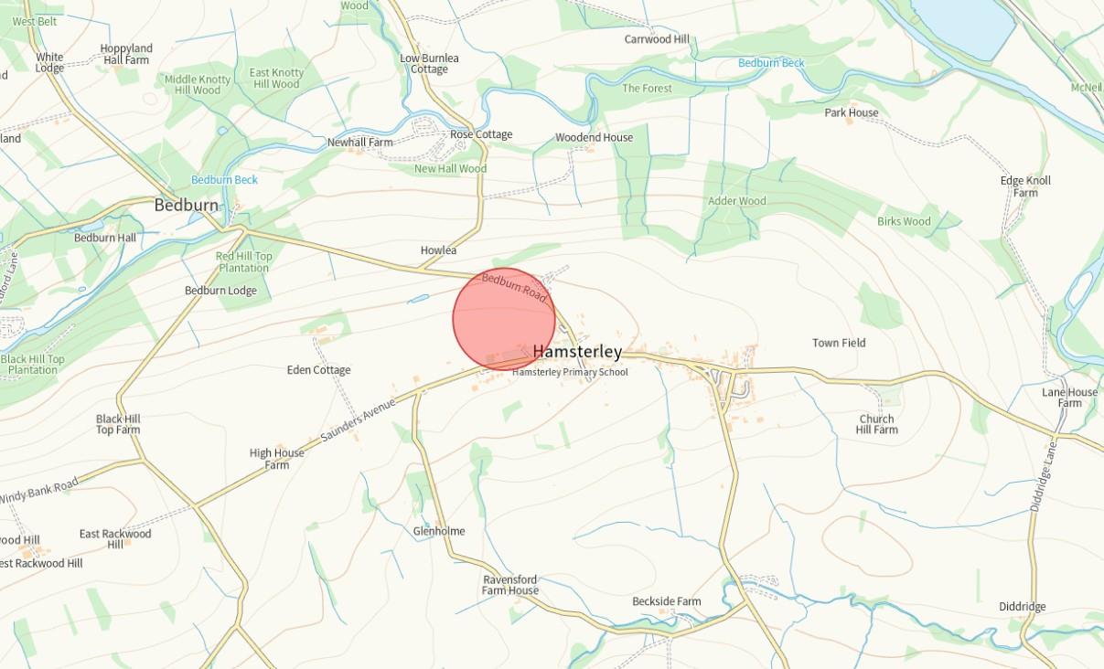
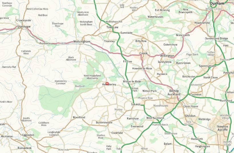
LOCATION
The land is situated to the north of Hamsterley village, directly to the north of Saunders Avenue and west of Bedburn Road.
Hamsterley is located approximately 9 miles to the west of Bishop Auckland, 9 miles to the south of Tow Law and 12 miles to the north of Barnard Castle.
What3words///kitten.steady.washed
DESCRIPTION
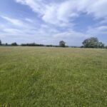
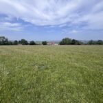
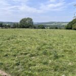
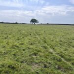
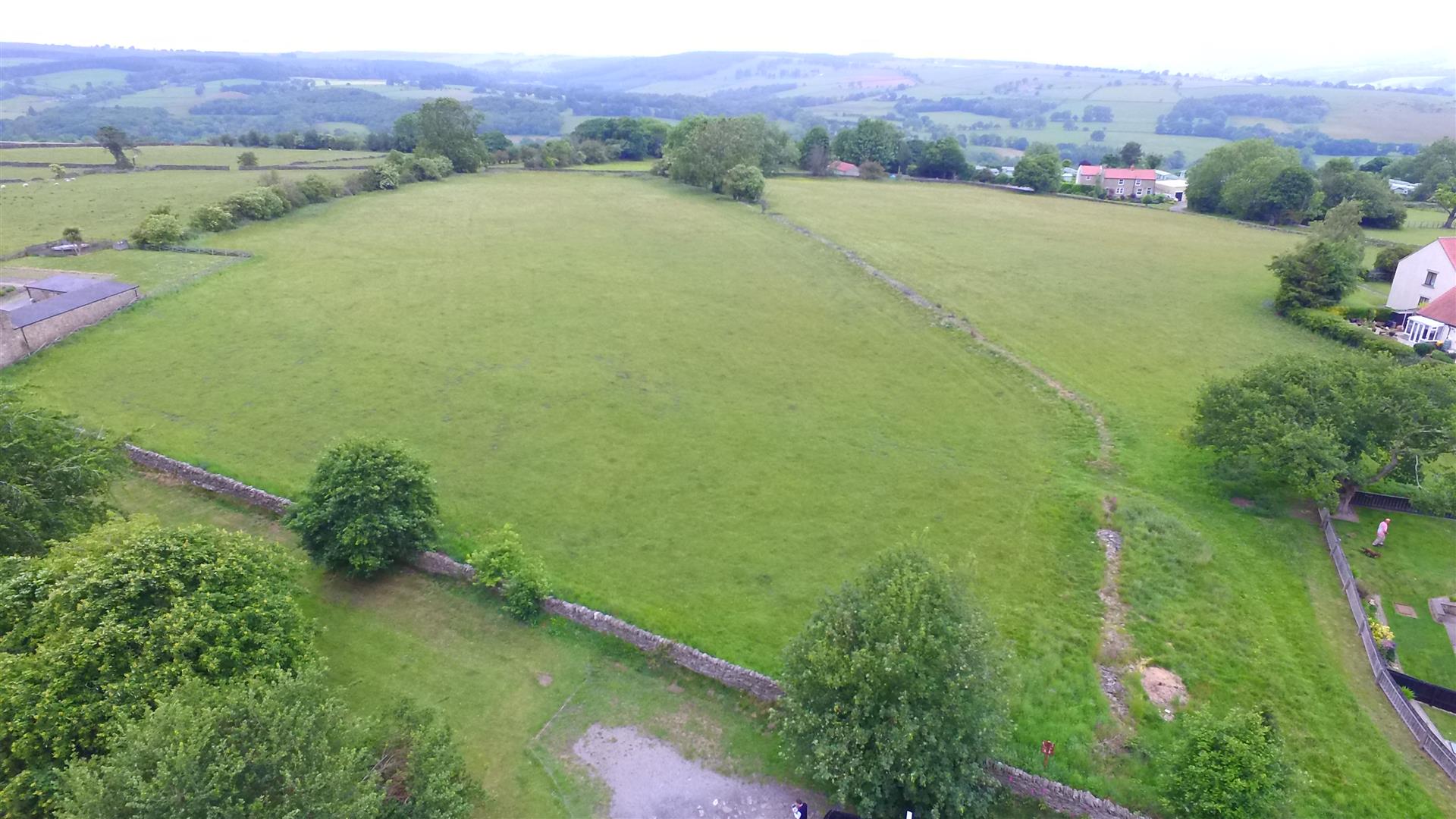
An attractive block of permanent grassland extending to 5.93 hectares (14.65 acres) in total.
Comprising 2.81 hectares (6.94 acres) of relatively flat meadow which is suitable for silage / hay production and 3.12 hectares (7.71 acres) of pasture which is predominately suited to livestock and equestrian grazing. The pasture gently slopes to the north towards Bedburn Road.
The land is available as a whole or in two lots.
Lot 1—2.81 hectares (6.94 acres) Guide Price £70,000
Lot 2—3.12 hectares (7.71 acres) Guide Price £45,000
The land can be accessed from Saunders Avenue, to the rear of Hamsterley Village Hall and Bedburn Road, directly from the highway.
The external boundaries comprise stone walls, post and wire fencing and hedging, they are stock proof but would benefit from repairs in some places. At present the pasture fields are run as one, as are the meadow fields.
There is a metered mains water connection currently serving the pasture fields.
The land is classified as Grade 4 and the soil type is described as slowly permeable, seasonally wet acid loamy and clayey soil.
OVERAGE
The land included in Lot 1 is sold subject to a clawback in favour of the vendors and their successors in Title entitling them to a further payment upon the grant of planning permission for anything other than agricultural or equestrian uses, on a bite and bite again basis, equivalent to 30% of the uplift in land value for a period of 25 years.
SERVICES
The land benefits from a metered mains water connection.
BASIC PAYMENT & AGRICULTURAL SCHEMES
The land is registered with the Rural Payments Agency and the de-linked basic payment has been claimed. The land is not subject to any other environmental or stewardship schemes.
MINERAL & SPORTING RIGHTS
We are advised the mineral rights are excluded and the sporting rights are in hand.
MATERIAL INFORMATION
It is understood that the land has a good mobile phone signal in this area. With reference to data from the Environment Agency’s Flood Warning Information Service there is a very low risk of flooding from surface water, rivers and sea.
COSTS
Each party is to bear their own costs.
MONEY LAUNDERING
Prospective buyers should be aware that in the event that they are successful they will be required to provide documents in relation to the current Money Laundering and Terrorist Financing Regulations. The extent of the required documentation will be confirmed to the purchaser(s) after acceptance of an offer.
TENURE
We are informed by the current vendors that the property is held freehold.
METHOD OF SALE
The property is offered for sale as a whole or in two lots by private treaty.
VIEWINGS
Please contact Vickers & Barrass Darlington office on 01325 728084 to arrange a viewing, which are strictly by appointment only.
LOCAL AUTHORITY
Durham County Council
www.durham.gov.uk
03000 26 0000
NOTES
Particulars prepared – June 2025
Photographs taken – June 2025
PARTICULAR NOTES
The particulars are set out as a general outline for the guidance of intending purchasers or lessees and do not constitute, all or part of an offer or contract; all descriptions, dimensions, areas, references to condition and necessary consents for use and occupation and other details are given as a guide only and without responsibility. Any intending purchasers or lessees should not rely on them as statements or representations of fact but must satisfy themselves, by inspection or otherwise, as to their accuracy.
No employee of Vickers & Barrass, Chartered Surveyors has the authority to make or give any representation or warranty whatever in relation to this property nor is any such representation or warranty given by the Vendors or the Lessors of this property.
Any offer for this property will be taken as an admission by the intending purchaser that they have relied solely upon their own personally verified information, inspection, and enquiries.
The photographs show only certain parts of the property. It should not be assumed that the property remains as displayed in the photographs.
Where any reference is made to planning permissions or potential uses, such information is given by Vickers & Barrass, Chartered Surveyors in good faith. Prospective purchasers should make their own enquiries with the Local Planning authority into such matters.
The Vendors reserve the right to amalgamate, withdraw or exclude either of the lots shown at any time and to generally amend the particulars or method of sale.
The property is sold subject to reserve(s). Vickers & Barrass, Chartered Surveyors reserve the right to sell privately without imposing a closing date and do not bind themselves to accept the highest or any offer.
The particulars have been prepared in accordance with the Business Protection from Misleading Marketing Regulations to give a fair overall view of the property.